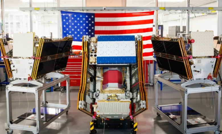
As smoke from hundreds of devastating wildfires choked the skies across Canada and the United States, a new era in wildfire detection began with the successful launch of the first three operational satellites in the Google-backed FireSat program. These advanced microsatellites, now in orbit, are poised to revolutionize early wildfire detection, promising the ability to spot even small ignitions across the United States, Australia, and Europe before the end of 2026.
The launch, which occurred on July 7, 2026, aboard a SpaceX Falcon 9 rocket from Vandenberg Space Force Base in California, signifies the transition of the FireSat constellation to "initial operational capability." Managed by the nonprofit Earth Fire Alliance, the constellation is the first of its kind specifically engineered for wildfire detection. Following a three-month calibration and testing period, these satellites will commence active data transmission to fire agencies, aiming to provide at least two daily passes over every fire-prone region on Earth.
Developed by the California-based satellite manufacturer Muon Space, FireSat represents a significant leap forward in Earth observation technology. The program has garnered substantial financial backing, with over $15 million from Google and a commitment of $26 million from the Bezos Earth Fund, underscoring the urgency and perceived value of enhanced wildfire monitoring capabilities.
A Technological Leap in Fire Detection
The core innovation of the FireSat satellites lies in their multispectral imaging capabilities, designed to penetrate smoke and cloud cover – persistent obstacles for traditional satellite surveillance. This advanced technology allows the satellites to detect fires as small as five by five meters (approximately 16 by 16 feet), a critical improvement over existing systems. This capability was rigorously tested by a FireSat Protoflight satellite, launched in March 2025. During its mission, the protoflight satellite captured over one million images, demonstrating its efficacy in identifying low-intensity blazes that had previously remained invisible to conventional satellite technology.

The implications of such granular detection are profound. Early identification of nascent wildfires can prevent them from escalating into large, uncontrollable infernos. The Earth Fire Alliance has projected that even an hourly revisit rate from the FireSat constellation could lead to substantial savings, potentially exceeding $1 billion annually in fire damage costs. Furthermore, it could prevent the emission of nearly 22 million tons of carbon dioxide, safeguard approximately 3,500 homes, and preserve 1.3 million acres of land.
Google’s AI Integration for Enhanced Analysis
Complementing the satellite hardware, Google Research is leveraging its advanced Artificial Intelligence (AI) models to amplify FireSat’s effectiveness. By comparing operational FireSat data with historical satellite imagery, Google aims to refine the identification of very small fires and bolster predictive modeling of wildfire behavior. Google celebrated the launch, framing it as "another tangible step forward in putting practical AI to work for climate resilience." This integration highlights a growing trend of utilizing AI not just for detection but also for understanding and mitigating the complex challenges posed by climate change.
Global Reach and Future Expansion
The initial operational phase will see "early adopter" organizations, including fire agencies in California, Colorado, Australia, and Portugal, begin utilizing FireSat data. The program’s ambition extends far beyond this initial deployment. By 2029, FireSat aims to provide near real-time imagery of any global location on an hourly basis. The ultimate goal is to achieve an hourly revisit rate across the entire planet once the full constellation of over 50 satellites is operational by the early 2030s. This comprehensive coverage will provide an unprecedented global view of fire activity.
The Worsening Wildfire Crisis and Climate Change Context

The launch of FireSat occurs against a backdrop of escalating wildfire activity globally, particularly exacerbated by climate change. The intense wildfires that have ravaged Canada’s boreal forests in recent years serve as a stark illustration of this crisis. These fires, characterized by their size and intensity, are directly linked to rising global temperatures driven by greenhouse gas emissions from fossil fuel consumption. Canada has experienced some of its most destructive wildfire seasons on record in 2023 and 2025, with the last three fire seasons ranking among the top ten worst.
"What is unfolding is what climate and forest scientists have been predicting for 30 years," noted Werner Kurz, a retired senior research scientist at Natural Resources Canada, in an interview with The Atlantic. "That as the world gets hotter and drier, we are exposing forests to more and more risk, and the old strategies of fire suppression are simply being overwhelmed."
This intensification of wildfires poses significant challenges for traditional firefighting methods. The vast, often remote, forest regions require specialized aerial resources, including fixed-wing air tankers and heavy-lift helicopters, to deliver fire retardants and transport firefighting crews. However, the burden of acquiring and maintaining these assets typically falls on individual Canadian provinces. In recent years, demand has often outstripped supply, with nearly all available aircraft being deployed simultaneously to combat blazes. To address this, the Canadian government has initiated efforts, such as leasing 10 new aerial firefighting aircraft and two support assets in 2026, to bolster nationwide response capacity.
The scale of the problem is immense. As of mid-July 2026, the Canadian Wildland Fire Information System reported nearly 900 active wildfires across the country, with over 3,600 fires having already burned more than 6.6 million acres year-to-date. The challenging reality for fire agencies is that dozens of these "out of control" fires are currently under observation rather than active suppression. This strategic decision-making is often necessitated by resource limitations and the imperative to prioritize firefighter safety.
The Paradox of AI and Energy Consumption
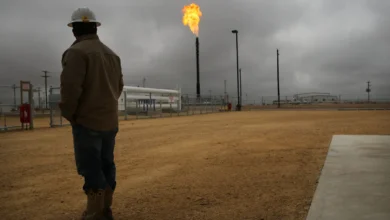
While FireSat represents a crucial advancement in wildfire mitigation, it also highlights a broader tension within the tech industry concerning the environmental impact of AI. The development and deployment of sophisticated AI models, including those powering wildfire detection systems, are intrinsically linked to the energy demands of large data centers. Many of these data centers rely on electricity generated from new natural gas projects, which contribute significantly to greenhouse gas emissions. Projections suggest that the cumulative emissions from these AI data centers could exceed 129 million tons of greenhouse gases annually.

Google itself has acknowledged the challenges of meeting the energy needs of its expanding data centers with clean energy sources. In 2025, the company’s company-wide electricity usage saw a substantial 37 percent increase, underscoring the growing energy footprint of AI infrastructure. This presents a complex challenge: developing technologies to combat climate change impacts like wildfires while simultaneously grappling with the environmental costs of the very technologies enabling these solutions.
Broader Implications for Wildfire Management
Beyond detection, effective wildfire management requires a multifaceted approach that includes ecosystem management through prescribed burns and robust suppression capabilities. Fire agencies are increasingly challenged by the escalating intensity and frequency of wildfires, a trend directly attributable to global warming. The environmental consequences are far-reaching, impacting air quality over vast regions, forcing evacuations of vulnerable communities, and threatening biodiversity and natural resources.
The FireSat program, therefore, arrives at a critical juncture. Its advanced detection capabilities offer a vital tool in the fight against increasingly formidable wildfires. However, its success will ultimately depend on the integrated efforts of technological innovation, governmental support, effective resource allocation for firefighting, and a concerted global commitment to addressing the root causes of climate change. The smoke may be visible, but the path to comprehensive wildfire resilience requires a sustained and coordinated response on multiple fronts.